Vietnam builds stations for global navigation satellite system
Vietnam is completing the construction for 65 Continuously Operating Reference Stations (CORS), using the Global Navigation Satellite System (GNSS) to provide highly accurate geo-spatial positioning.
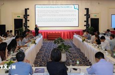
 At the meeting held by the Ministry of Natural Resources and Environment’s Agency for Survey and Mapping (Photo: baotainguyenmoitruong.vn)
Hanoi (VNA) – Vietnam is completing the construction for 65 Continuously Operating Reference Stations (CORS), using the Global Navigation Satellite System (GNSS) to provide highly accurate geo-spatial positioning.
The information was heard on July 23 at a meeting of the Ministry of Natural Resources and Environment’s Agency for Survey and Mapping to report the results of the project on building a network of satellite-based global positioning stations in Vietnam.
The stations provide GPS data to support every accurate positioning not only in map survey but also in transport, environment, geophysics, construction, and agriculture.
According to head of the agency Phan Duc Hieu, the project is to form a network of global positioning stations that help detect movements of tectonic plates, and enhance weather forecast capacity, serving the national target programme on climate change response.
Actually, application of GNSS has shown efficiency, with coordinate deviation less than 5 centimetres, he said, adding that more than 280 organisations and individuals have registered to use the service so far, and the number will increase when the CORS become operational in the central and southern regions.
Vietnam is planning to build 160 CORS applying GNSS.-VNA


You should also see

China’s fishing ban in East Sea violates Vietnam’s sovereignty: spokesperson
Foreign Ministry spokesperson Pham Thu Hang on April 25 said Vietnam’s consistent stance on China’s fishing ban in the East Sea, which has been affirmed clearly over the past years.


See more
 Environment
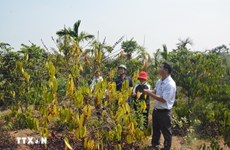
Drought at peak dry season impacts over 20,000ha of farmland
About 20,090ha of farmland and over 2,600 households have been hit by drought and water scarcity in the central region, Central Highlands, and southeastern region, which are now in the peak period of the 2023 - 2024 dry season.
 Environment
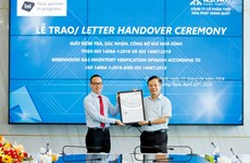
Hoa Phat steel products certified to meet greenhouse gas inventory standard
Vietnamese steel giant Hoa Phat Group has announced that BSI - the UK's leading international certification organisation - certified ISO 14064-1:2018 standard and ISO 14067:2018 on greenhouse gas inventory for steel products of its subsidiary - Hoa Phat Dung Quat Steel JSC.
 Environment
Vietnam supports global agreement on plastic pollution
A delegation of Vietnamese negotiators joined those from 176 countries worldwide at the fourth session of the Intergovernmental Negotiating Committee (INC-4) on plastic waste in Ottawa, Canada, on April 23.
 Environment
Consultation workshop on Cambodia’s Funan-Techo canal held in Can Tho
The Vietnam National Mekong Committee (VNMC) on April 23 held a consultation workshop on Cambodia’s proposed Funan-Techo canal project which has raised concerns about potential impacts on the Mekong river.
 Environment
Up to 1,000 ban flowers planted at Dien Bien Phu battlefield relic sites
About 1,000 ban (Bauhinia variegate) flower trees were planted at relic sites such as A1 Hill, Him Lam resistance centre and De Castries Bunker at Dien Bien Phu battlefield relic complex in the northern province of Dien Bien on April 21.