Extreme weather forecast for start of 2019
Up to five cold spells are predicted to hit the northern region in January, according to the National Centre for Hydro-Meteorological Forecasting.
 The direction of typhoon PABUK (Source: National Centre for Hydro-Meteorological Forecasting)
Hanoi (VNS/VNA) - Up to five cold spells are predicted to hit the northern region in January, according to the National Centre for Hydro-Meteorological Forecasting.
Downpours are expected in the entire central region while extreme weather events such as tornadoes and hailstorms could hit the Central Highlands and southern regions.
Average temperatures in different regions in January will be higher than those of previous years, by between 0.5 to 1 degree Celsius.
Total rainfall in the north will also experience an upward trend, mostly in the first half of the month, while the central region will see rainfall 20 to 50 percent higher than previous years.
Off-season rains will appear in the Central Highlands and southern regions on the first ten days of the year.
The first storm of 2019, internationally called Typhoon PABUK, formed in the southwest of the Spratly Islands on January 1.
At 13.00 on January 1, the storm’s eye was seen 450km southeast of Con Dao island. Wind speeds at the eye reached up to 75 km per hour. The storm is predicted to move west – southwest at 10 to 15km per hour and be 280km southeast of Con Dao island.
With the effects of the storm and extreme cold spells, strong winds are forecast to hit the western area of the East Sea, as well as seas of provinces from Quang Ngai to Binh Thuan and from Ba Ria – Vung Tau to Ca Mau.
Preparing for the upcoming storm, from 12:00 on January 1, the People’s Committee of Ca Mau province prohibited boats and ships from operating in the provincial sea.
Authorities of coastal provinces from Quang Ngai to Ca Mau and Kien Giang urged related agencies including rescue forces and media to track the storm’s movement, monitor ships and mobilise search and rescue teams in case of emergency.-VNS/VNA


You should also see

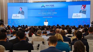
PM hosts Chairman of Russian Federal Bar Association
Prime Minister Pham Minh Chinh spoke highly of cooperation between the Russian Federal Bar Association (RFBA) and the Vietnam Lawyers’ Association (VLA) while receiving RFBA Chairman Sergey Stepashin, who is also former Prime Minister of Russia, in Hanoi on April 23.


See more
 Environment
Can Tho explores climate change cooperation with foreign countries
Leaders of the Mekong Delta city of Can Tho on April 17 met with a visiting delegation from the Embassies of Canada, New Zealand, Norway, and Switzerland to discuss issues related to erosion, climate change, migration, and the city's current needs for support and cooperation.
 Environment
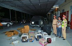
Nghe An: Man captured for illegal wildlife transport
Police in Vinh city, the central province of Nghe An, have captured a suspect involved in the illegal transport of 420 rare wildlife animals, including parrots, kangaroos, turtles, and monkeys.
 Videos
Vietnam works to prevent biodiversity degradation
Vietnam is recognised as one of the countries with the richest biodiversity in the world with different ecosystems including tropical forests, marine and coastal ecosystems. However, experts from the World Wide Fund for Nature in Vietnam said that Vietnam's biodiversity is degrading.
 Environment
Communication campaign calls for wildlife conservation efforts
The central province of Quang Binh, home to the UNESCO-recognised Natural Heritage site of Phong Nha Ke Bang National Park, on April 13 launched a communication campaign in response to the World Wildlife Day (March 3) and the National Biodiversity Restoration Year 2024.
 Environment
Saigon Co.op ties up with Winrock International for waste circulation
Saigon Co.op signed an MoU with non-profit Winrock International in HCM City on April 12 to reduce environmental pollution by developing a waste circulation model, enhancing waste separation at source and raising the extended producer responsibility.